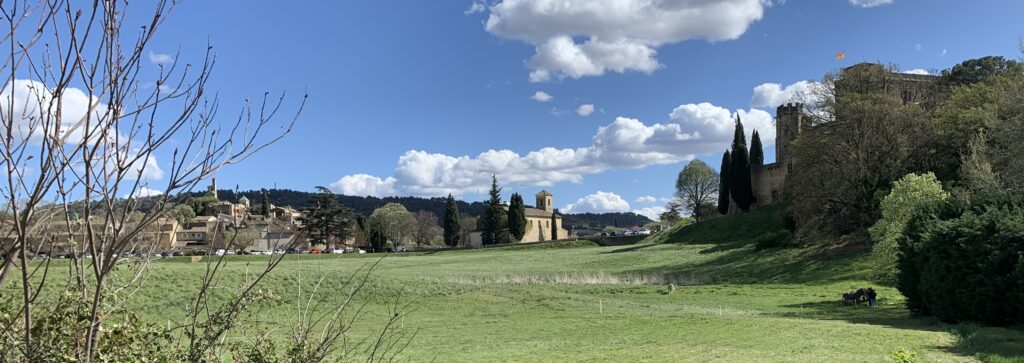
Bonnieux – Petit Luberon – Lourmarin
Walking time: 6 hours
Elevation gain: 760 m
Distance: 20 km
Requirements: good footwear required, very good physical condition.
Starting point: Café Clerici, 2 Place du 4 Septembre, 84480 Bonnieux
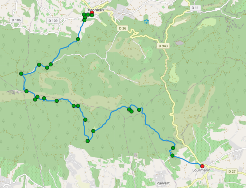
Route description
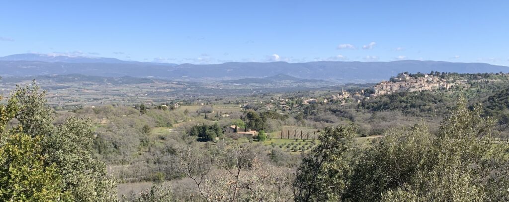
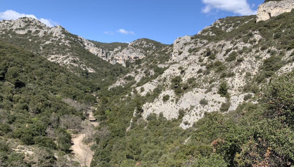
From Café Clerici on Place du 4 Septembre, take Rue Raspail and follow it until you reach Chemin Saint-Gervais. Turn right here and at the next opportunity, turn left down to the stream and continue straight ahead along a narrow road that takes you round a left-hand bend to the D3. Take the D3 a few steps to the left and turn left into Chemin de Lunel. Walk past the l’Amaret estate until you reach a house where a footpath continues straight ahead. This is your way up to the Forêt des Cèdres, you should now be walking for about 25 minutes. For the next 40 minutes, walk up this beautiful hiking trail and enjoy the many marvellous views of Bonnieux and the vast Provence countryside.
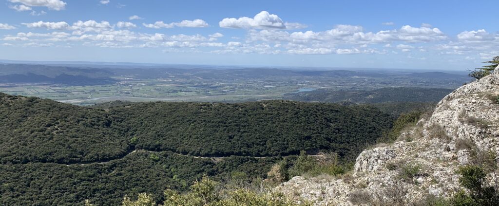
After a good hour in total, you will reach the forest road on the ridge of the Petit Luberon. Continue along this road to the right. After about one kilometre, you will come to a few car parks and a barrier. Shortly afterwards, a hiking trail turns off to the right towards Le Portalas. Follow this signposting. After a short time, the path descends steeply and then climbs again in a right-hand bend. At the Le Portalas signpost, follow the signs to Lauris in a southerly direction. A macchia path leads you to a rocky plateau from where you can enjoy an incredible view to the south and west.
Here you follow the yellow markings down the ridge of the Luberon to the P.L.230 road. Follow this road a little to the left downhill until a hidden forest path turns off to the left in a sharp right-hand bend. This path is marked red and yellow and takes you downhill to another bend in the P.L.230 road. Continue downhill until you reach the Combe de Recaute signpost at a relatively flat point, which leads you left towards Combe du Sautadou. From here you can go uphill again.
The winding path takes you to the top of the hill and then down into the Combe du Sautadou valley. Here you come to a wide track, which you follow to the right in a southerly direction. At a large house, turn left towards Cadassès. The markings are still red and yellow. After about 20 minutes, you will pass a cistern. From here, the road begins to turn into a gravel track, which soon becomes very steep. At a crossroads, turn right and continue along the hiking trail (still marked red-yellow) up to Cap de Serre.
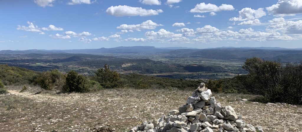
You should now have been hiking for 4.30 hours. Once again you will be rewarded with a fabulous view. This time towards the south, the great Luberon, Lourmarin and Marseille. Continue to follow the yellow markings and shortly afterwards you will come to the Cadassès signpost pointing you towards Lourmarin. From here it is another 4.5 kilometres and approx. 1.5 hours’ walk. A beautiful hiking trail through boxwood, juniper, rosemary and thyme bushes. In between forest, then great views again. At the end, the path leads over paved walls to a dirt track to the Chemin de Pierrouret road, which takes you to Lourmarin.