Buoux – Sivergues – Buoux
A very varied hike that takes you through the Aiguebrun valley. This is the only river in the Luberon that carries water all year round and therefore provides a habitat for many special plant species (Aiguebrun = good, brown water). In addition to the cool water, the rugged rock faces create a unique atmosphere. On the way back, an agricultural landscape with many hidden lavender fields awaits you.
Walking time: 3.5 hours
Elevation gain: 520 m
Distance: 11 km
Requirements: Good footwear required
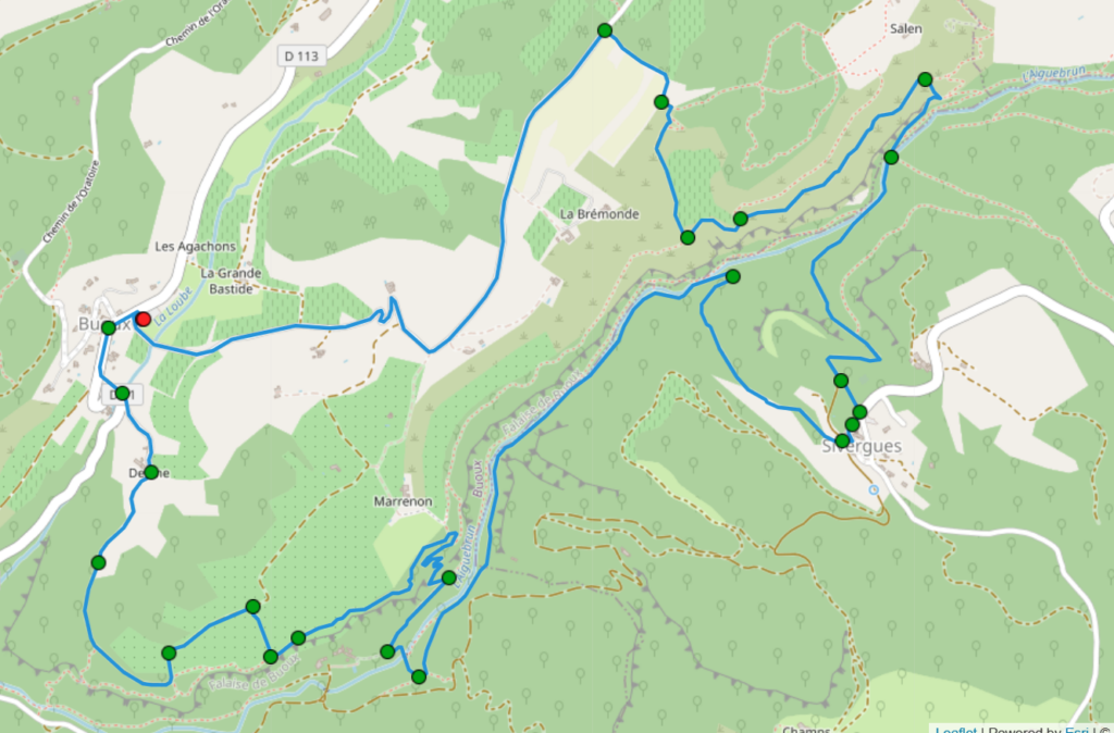
Starting point: Car park in Buoux, 12 km west of Bonnieux (at the red dot)
Route description
The hiking tour starts at the car park in Buoux, 12 km west of Bonnieux (at the red dot).
Buoux – Segun
From the car park, walk past the old wash house through the small village. Behind the Gite d’Etappe La Sparagoule, a small track leads off to the left, which takes you to a bridge. Cross it and follow the path straight ahead uphill towards La Bastide de Deyme. There are yellow, red and blue signposts that you can follow for the time being. Follow the path in a long left-hand bend until you reach a large lavender field. Here you come to a marked path that leads downhill to the right. A hiking signpost shows you that it is another 4.5 kilometres to Sivergues from here. After a short stretch, you are right on the steep edge of the Aiguebrun valley. You can see the roofs of Segun below you.
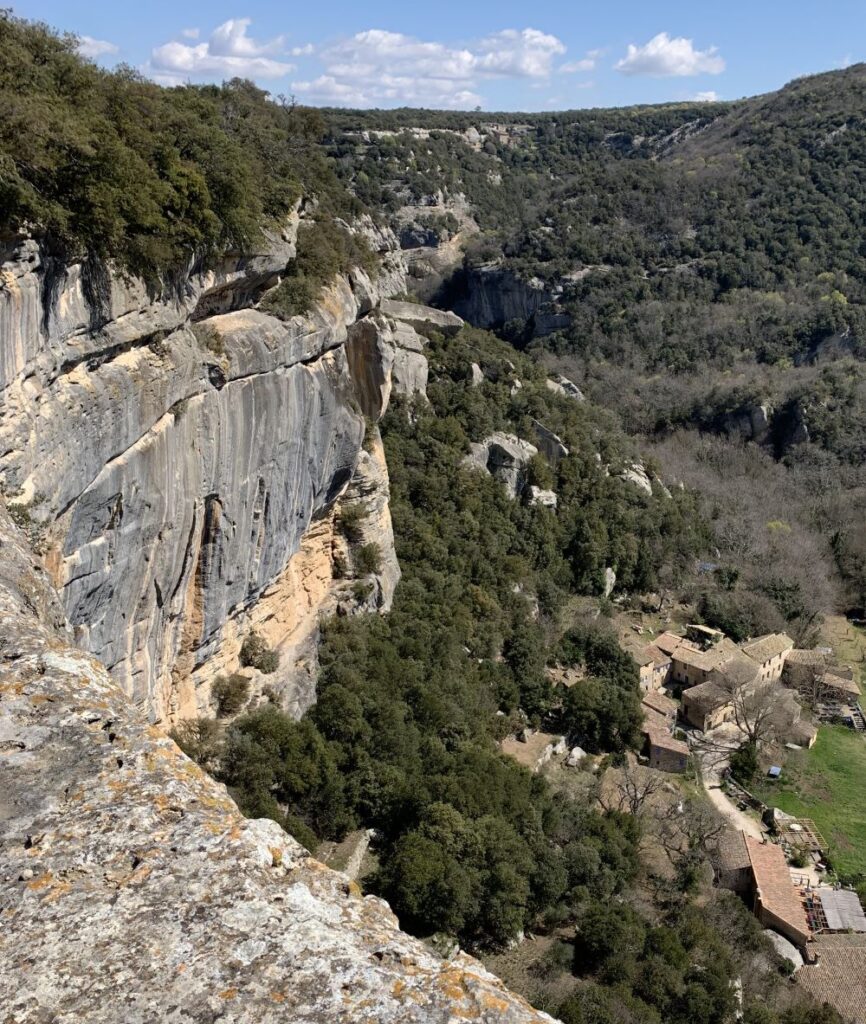
Segun – Sivergues
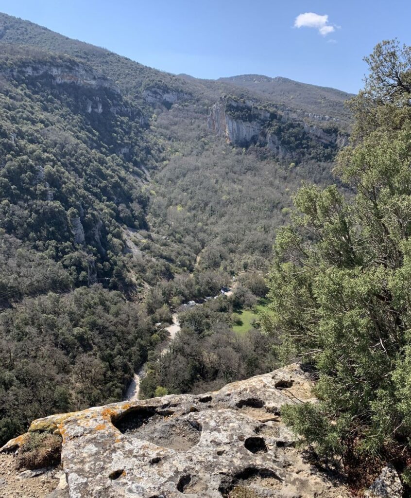
The eroded rocks are very impressive and drop steeply. You follow the red and yellow markings to the left and then descend in short hairpin bends past rock formations that attract lots of climbers, down to the Aiguebrun. Cross the stream over a bridge, continue straight ahead and come to a fork in the path. Here you follow the signs for Sivergues to the left and return to the banks of the Aiguebrun. You now walk between box trees along the babbling brook for approx. 2 km. On the right, you will see impressive rock faces again and again. On the other bank, you have a clear view of the rocks opposite, on which climbers are hanging. After approx. 2 km, a path branches off to the right, leading you up out of the valley, past terraced, green meadows until you reach Sivergues.
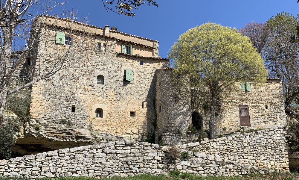
Here you are at the highest point of the hike and also about halfway round the route. A good opportunity for a break: there is a stone picnic bench right next to the small chapel that invites you to take a break.
Sivergues – La Brémonde
Freshly fortified, the route continues. Cross the D 114 and take a wide track opposite the car park. Shortly afterwards, the path bends to the left, but you continue straight ahead at the sign marked Aiguesbrun and soon you will see another blue dot as a web marker. The path now descends at a leisurely pace to Aiguesbrun. Cross the river and head uphill again on the other side. After a few metres in altitude, you come to a plateau where a path turns off to the left at a sharp angle. Take this path so that you are now walking parallel to the course of the river on the hill. This is a beautifully laid out path through low juniper bushes and boxwoods. The view sweeps over a green hilly landscape, with hardly any rugged rocks in sight. For a few hundred metres, you can hardly believe you are in Provence. Until you reach the many lavender fields at the top of the hill.
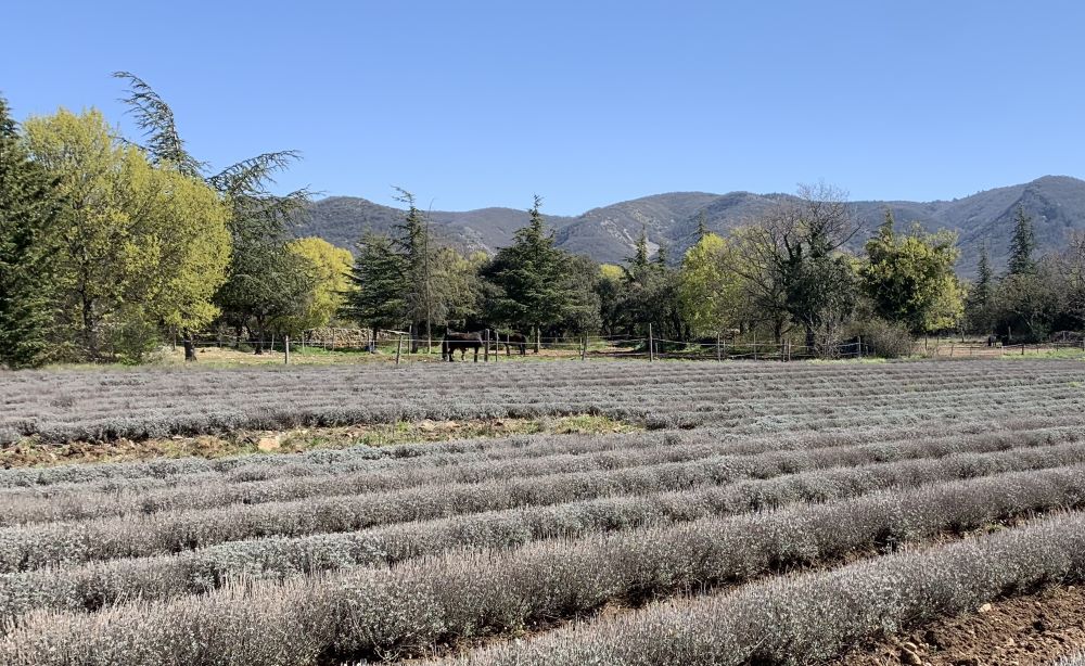
La Brémonde – Buoux
The path takes you left along one of the fields, bends to the left and ends on a tarmac road. On the left, you pass the La Brémonde horse farm and shortly afterwards take a right-angled bend to the right. Stay on the little-used road, which will take you back to the car in Buoux.